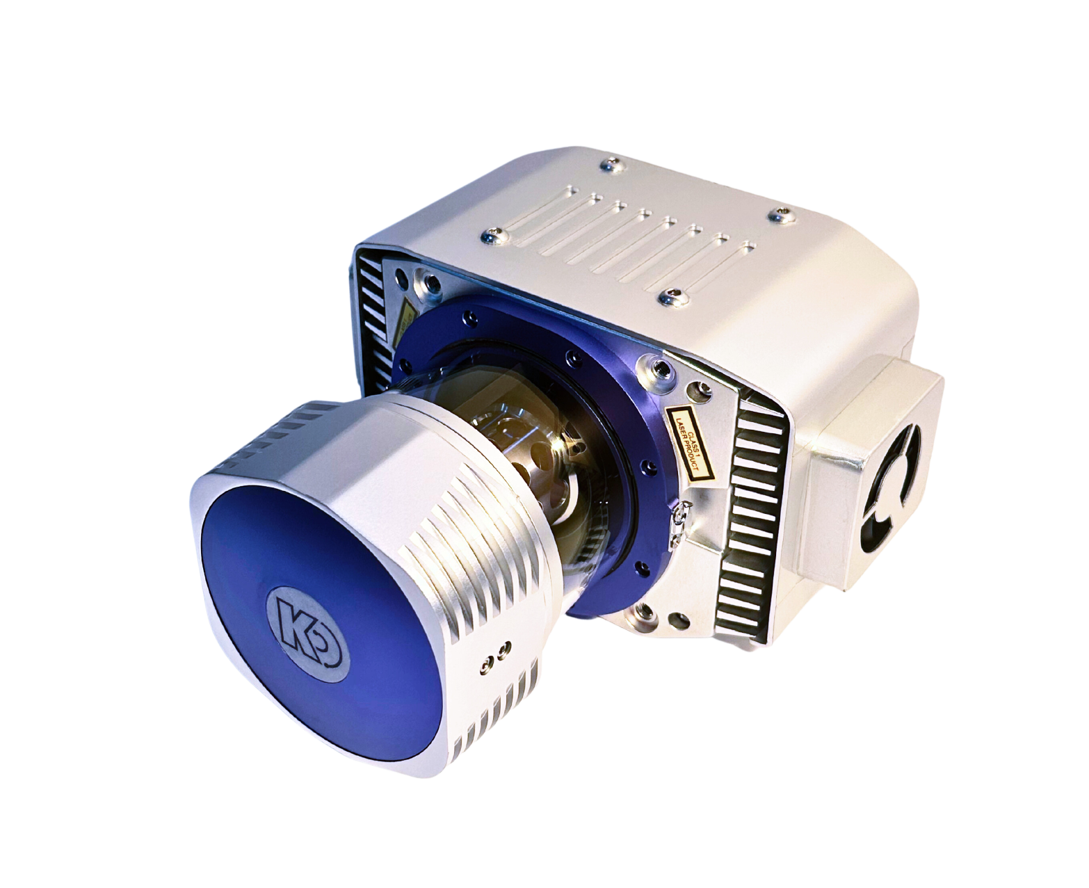
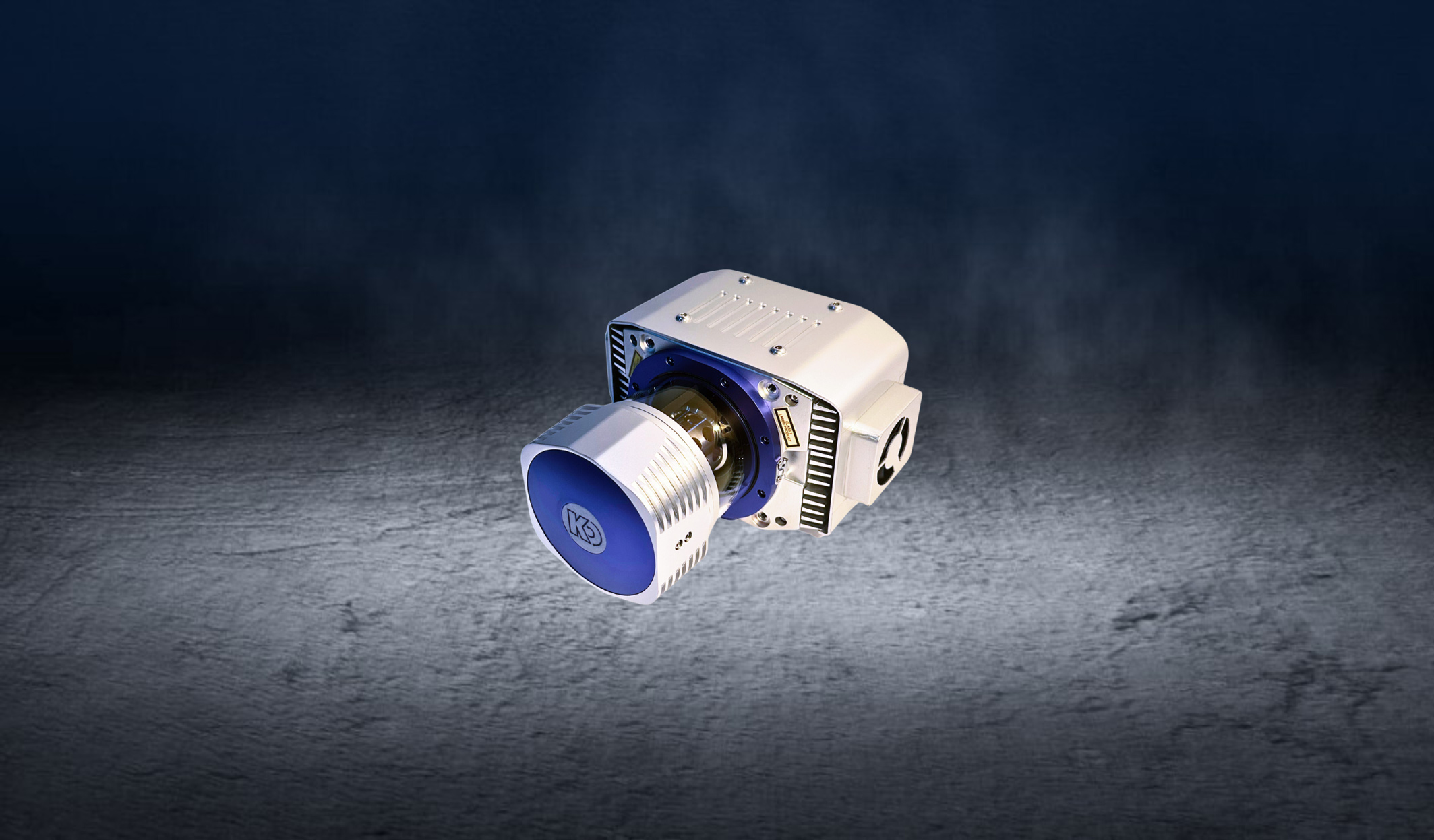
KS2900Series LiDAR
A long-distance high-precision laser scanning system with strong penetration, high precision, multiple platforms, multiple echoes, and high cost-effectiveness It can be widely used in terrain surveying, smart cities, power inspection, high-precision electronic maps, oil pipeline inspection, agricultural and forestry surveys, natural resource surveys, emergency surveying and other fields.
Full angle scanning brings a brand new perspective
-
Suitable for multiple loading platforms
Can be used for various measurement platforms such as drones, manned vehicles/cars, trains, etc
-
Long range measurement
The farthest measurement distance can reach 1500 meters
-
360 ° full angle scanning
More conducive to road environment measurement
-
Multiple echoes
Capable of handling multiple complex environments
-
High point frequency
Laser pulse repetition rate can reach 2000kHz
-
High precision
Repetitive accuracy ± 5mm
-
Laser pulse repetition rate
100-2000kHz
-
Maximum laser emission frequency
1 million points/s
-
power dissipation
50W
Download
-
KS2900light detection and ranging
The KS2900 LiDAR measurement system is a high-precision measurement system launched for industries such as surveying and mapping, power, forestry, and emergency response. The multi rotor unmanned aerial vehicle is equipped with a radar system that operates for about 50 minutes. It can plan regional routes, strip routes, cross routes, and ground simulation flight missions based on the operational measurement area, and collect high-precision point cloud raw data; The KMeta series post-processing software can output high-precision LAS point cloud data, which can meet the data requirements of various industries.
MORE
-
KS2900OSC in vehicle mobile measurement system
The KS2900-OSC onboard mobile measurement system consists of four parts: an external scanning system, an internal power supply control system, a roof mounting bracket, and data processing software. It can achieve the collection of massive point cloud data and high-precision panoramic camera data, with a lightweight design that is easy to assemble, and is widely used in fields such as highway street surveys and high-precision maps.
MORE
Application Scenarios
-
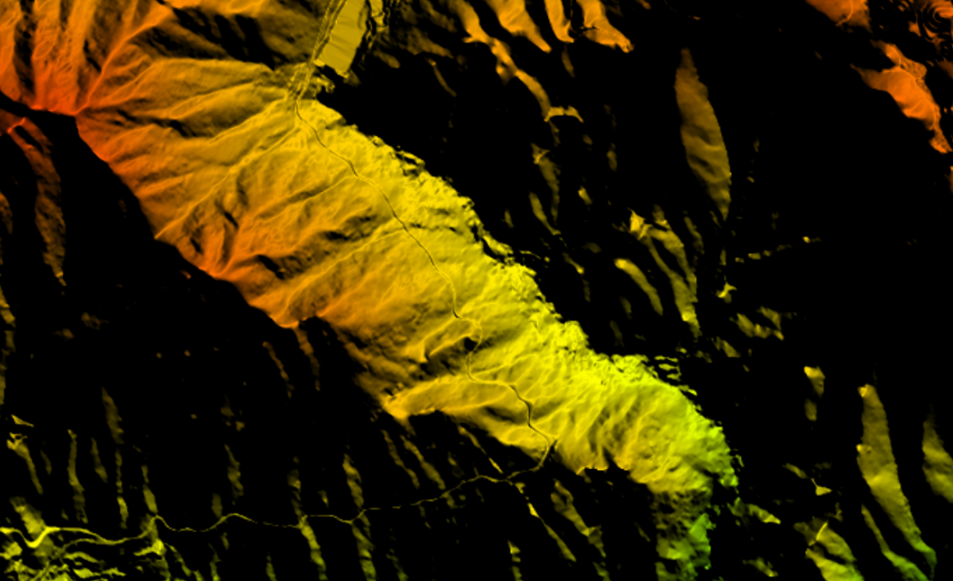
Topographic surveying
Using technologies such as remote sensing, lidar, and aerial photography, basic geographic information is provided for national economic and social development, as well as for various departments and professional surveying and mapping in the country. Basi
-
Smart City
High-precision building information model automation and digital modeling; precision surveying and urban information model automation and digital modeling; filling the gap in domestic equipment, providing various standard and customized solutions.
-
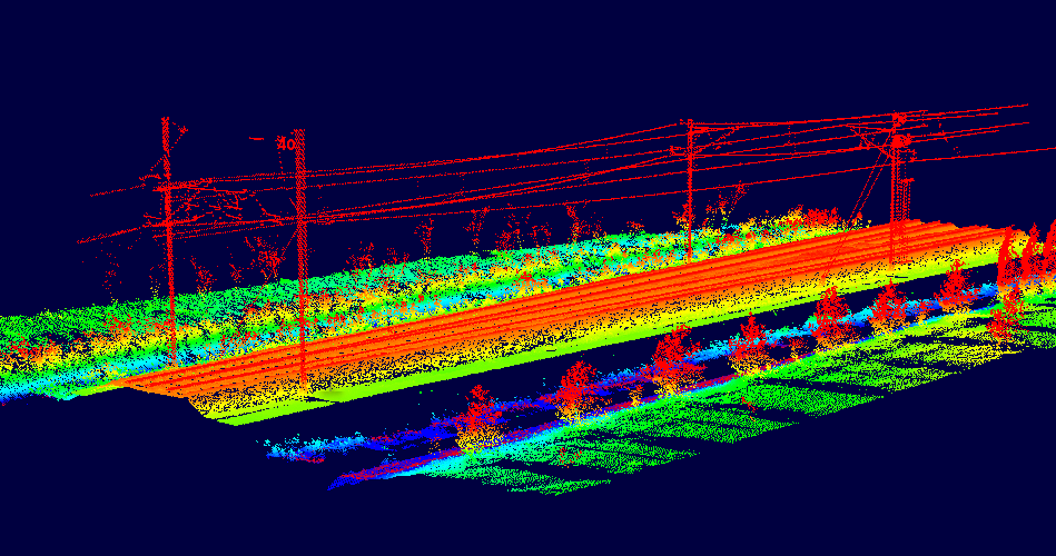
Power inspection
Utilizing our proprietary LiDAR technology, coupled with a digital platform for power grid inspection, we aim to establish a comprehensive and efficient digital inspection system for the power grid. This system is designed to promptly identify and address
-
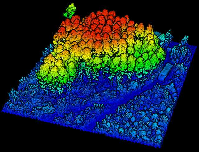
Smart Forestry
Kyle Optics has injected strong technical momentum into forestry surveying and mapping applications through the deep integration of independently developed laser radar and hyperspectral technology. Our system is capable of conducting high-precision and hi