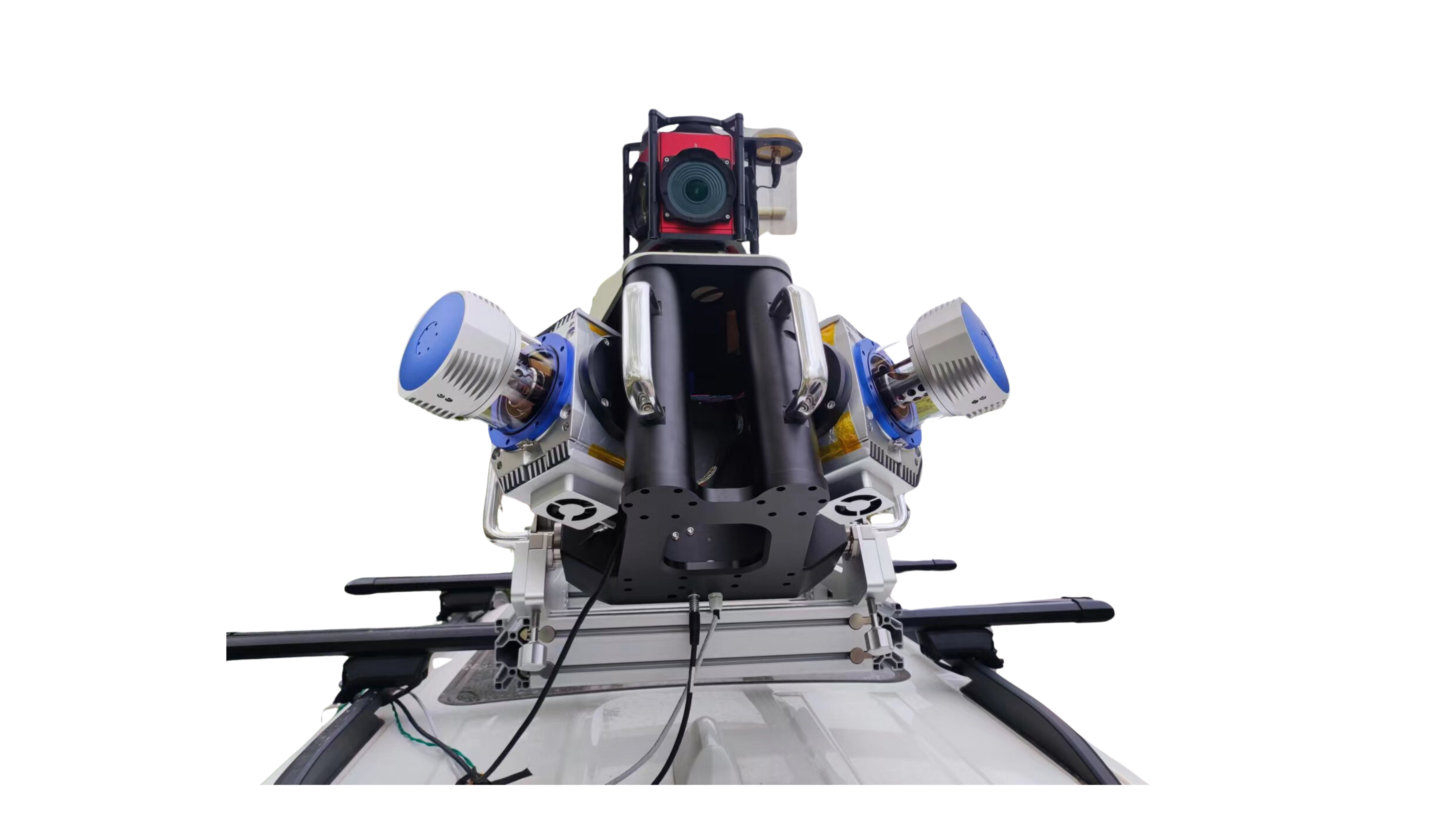
KS2900OSC in vehicle mobile measurement system

The KS2900-OSC onboard mobile measurement system consists of four parts: an external scanning system, an internal power supply control system, a roof mounting bracket, and data processing software. It can achieve the collection of massive point cloud data and high-precision panoramic camera data, with a lightweight design that is easy to assemble, and is widely used in fields such as highway street surveys and high-precision maps.
Full angle scanning brings a brand new perspective
-
Suitable for multiple loading platforms
The farthest measurement distance can reach 1000 meters,The minimum measurement distance is less than 1 meter
-
Easy to operate
Easy to install and operate
-
360 ° full angle scanning
More conducive to road environment measurement
-
Multiple echoes
Five echoes
-
High point frequency
Laser pulse repetition rate can reach 2000kHz
-
High precision
Repetitive accuracy ± 5mm
Superb performance and uniqueness
-
Laser pulse repetition rate
100-2000kHz
-
System weight
5kg
-
power dissipation
Maximum 150W
Download
-
KS2800light detection and ranging
The KS2800 LiDAR measurement system is a high-precision measurement system launched for industries such as surveying and mapping, power, forestry, and emergency response. The multi rotor unmanned aerial vehicle is equipped with a radar system that operates for about 50 minutes. It can plan regional routes, strip routes, cross routes, and ground simulation flight missions based on the operational measurement area, and collect high-precision point cloud raw data; The KMeta series post-processing software can output high-precision LAS point cloud data, which can meet the data needs of various industries.
MORE
-
KS2900light detection and ranging
The KS2900 LiDAR measurement system is a high-precision measurement system launched for industries such as surveying and mapping, power, forestry, and emergency response. The multi rotor unmanned aerial vehicle is equipped with a radar system that operates for about 50 minutes. It can plan regional routes, strip routes, cross routes, and ground simulation flight missions based on the operational measurement area, and collect high-precision point cloud raw data; The KMeta series post-processing software can output high-precision LAS point cloud data, which can meet the data requirements of various industries.
MORE
Application Scenarios
-
Traffic violation detection
By utilizing speed measurement technology to determine whether a vehicle is speeding and distance monitoring technology to assess whether it maintains a safe distance, timely warnings can be issued and illegal behaviors can be recorded.
-
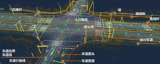
Road asset inventory
Utilizing a vehicle-mounted LiDAR system, road information can be collected, and map elements such as road shapes, road markings, traffic signs, and obstacles can be extracted through relevant software, enabling road asset inventory.
-
Road widening and reconstruction
Utilizing vehicle-mounted or airborne LiDAR systems to collect road-related information, as an advanced integrated measurement technology, can effectively address the issues of long measurement cycles and safety concerns during road reconstruction and exp
-
High-precision map
The road information is collected using a vehicle-mounted LiDAR system, and the collected data is processed by relevant software to generate high-precision maps for autonomous driving.