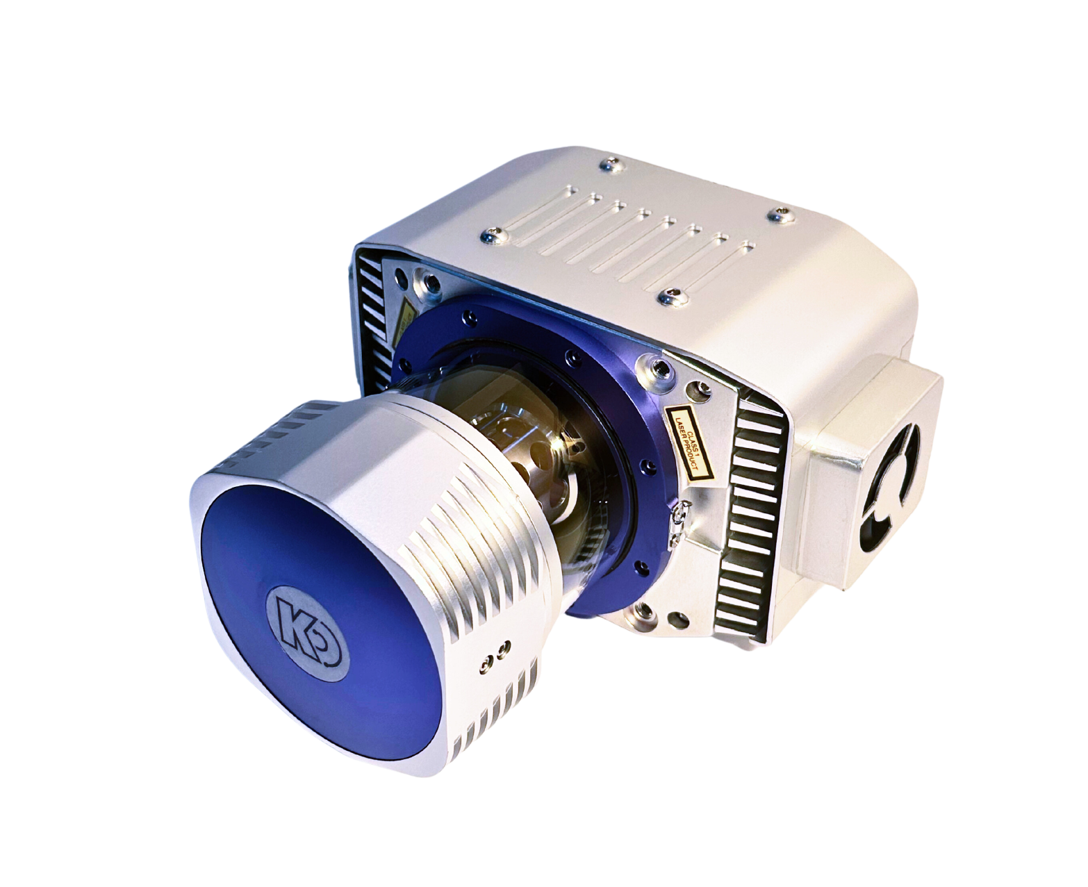
KS2900light detection and ranging
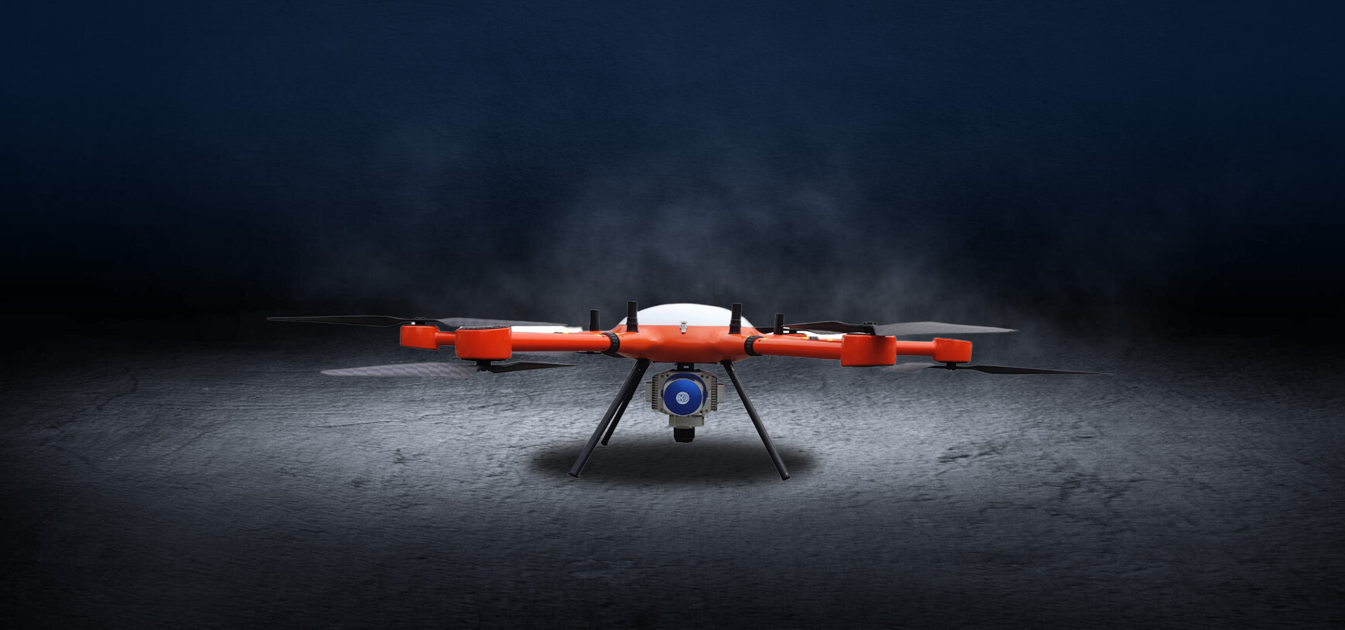
The KS2900 LiDAR measurement system is a high-precision measurement system launched for industries such as surveying and mapping, power, forestry, and emergency response. The multi rotor unmanned aerial vehicle is equipped with a radar system that operates for about 50 minutes. It can plan regional routes, strip routes, cross routes, and ground simulation flight missions based on the operational measurement area, and collect high-precision point cloud raw data; The KMeta series post-processing software can output high-precision LAS point cloud data, which can meet the data requirements of various industries.
Full angle scanning brings a brand new perspective
-
High Efficiency
Can quickly collect various point cloud data and image data
-
Multiple Scenes
Applicable to multiple scenarios
-
Long range measurement
The farthest measurement distance can reach 1500 meters
-
Multiple echoes
Five echoes (customizable infinite echoes)
-
High point frequency
Laser pulse repetition rate can reach 2000kHz
-
High precision
Repetitive accuracy ± 5mm
Superb performance and uniqueness
-
Laser pulse repetition rate
100-2000kHz
-
Maximum line frequency
300 Line/second
-
System weight
3.5kg
Download
-
KS2900Series LiDAR
A long-distance high-precision laser scanning system with strong penetration, high precision, multiple platforms, multiple echoes, and high cost-effectiveness It can be widely used in terrain surveying, smart cities, power inspection, high-precision electronic maps, oil pipeline inspection, agricultural and forestry surveys, natural resource surveys, emergency surveying and other fields.
MORE
-
KS2900light detection and ranging
The KS2900 LiDAR measurement system is a high-precision measurement system launched for industries such as surveying and mapping, power, forestry, and emergency response. The multi rotor unmanned aerial vehicle is equipped with a radar system that operates for about 50 minutes. It can plan regional routes, strip routes, cross routes, and ground simulation flight missions based on the operational measurement area, and collect high-precision point cloud raw data; The KMeta series post-processing software can output high-precision LAS point cloud data, which can meet the data requirements of various industries.
MORE
Application Scenarios
-
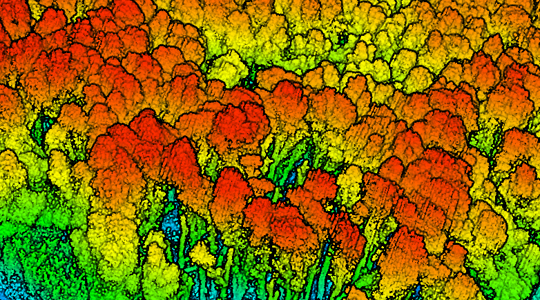
Forestry tree resource survey
Conduct a survey on forestry tree resources. Provide a scientific basis for formulating forestry policies, planning forestry development, and adjusting management strategies
-
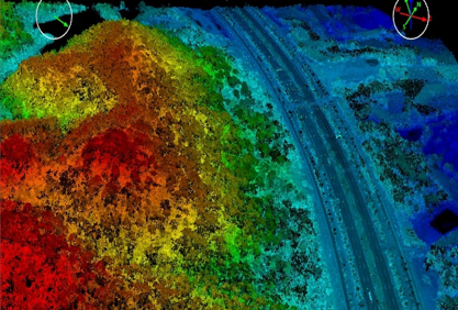
Earthwork measurement
The design phase prior to engineering construction must include a budget for earthwork and stonework quantities, as it directly impacts the cost estimation and optimal scheme selection of the project. The use of an airborne laser radar measurement system
-
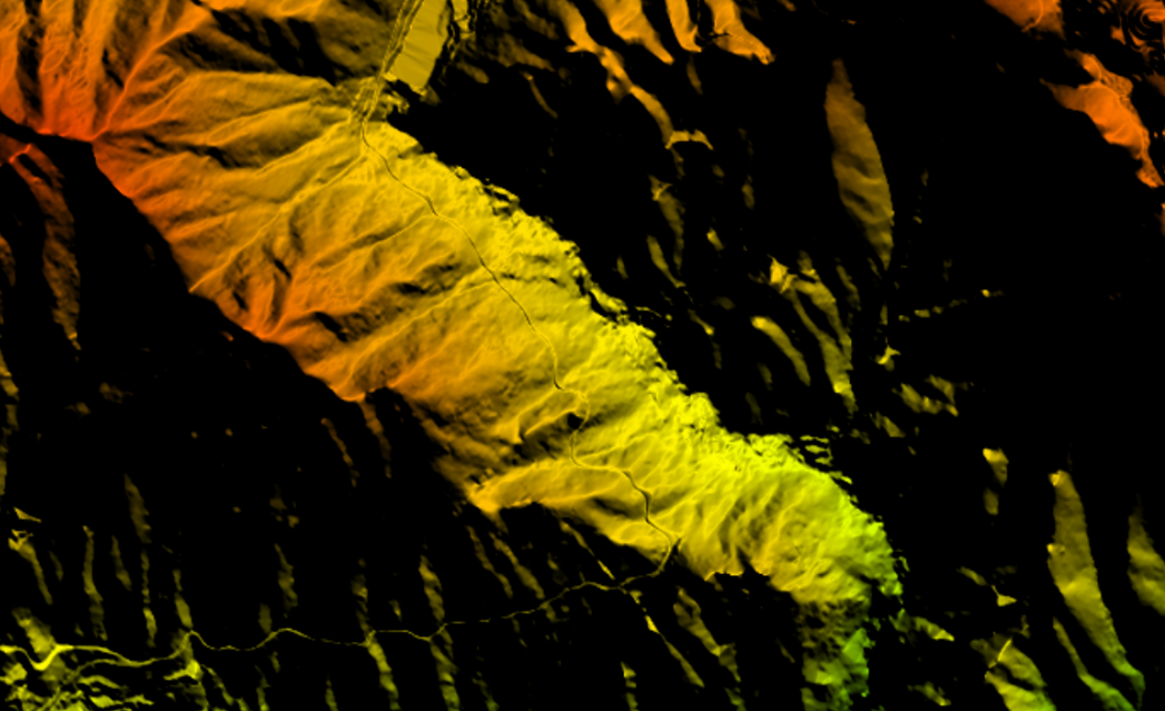
Topographic surveying
Using technologies such as remote sensing, lidar, and aerial photography, basic geographic information is provided for national economic and social development, as well as for various departments and professional surveying and mapping in the country. Basi
-
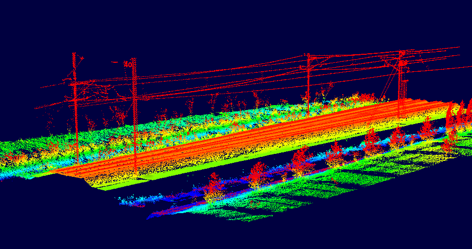
Power inspection
Utilizing our proprietary LiDAR technology, coupled with a digital platform for power grid inspection, we aim to establish a comprehensive and efficient digital inspection system for the power grid. This system is designed to promptly identify and address